
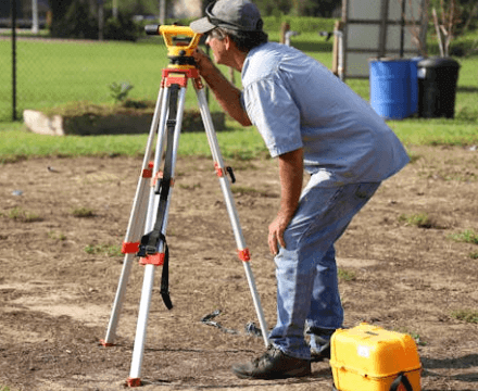
Understanding the land survey cost in Thonotosassa, Florida, is crucial whether you plan to buy, sell, or develop property. On average, a land survey in Hillsborough County costs $514, with prices typically ranging from $216 to $813, depending on factors like property size and survey type. Accurate land surveys are essential for defining property boundaries and ensuring smooth transactions. Steve Daria and Joleigh guide clients through buying or selling land with expertise and dedication. With their in-depth expertise and the option of cash deals, they simplify the process, ensuring a seamless and stress-free experience. If you’re curious about the land survey cost in Thonotosassa, Florida, and how it applies to your goals, you’re just one step away from expert advice. Book a free discussion with Steve Daria and Joleigh today to confidently start your property project!
Key Points
- Average Land Survey Costs: On average, land surveys in Thonotosassa, Florida, cost around $514. The price range can vary between $216 and $813, influenced by the property’s size and the survey’s complexity.
- Factors Influencing Costs: Key factors impacting land survey costs include the type of survey, terrain, and property size. Complex projects involving topography or boundary disputes may increase the final price.
- Why Land Surveys Matter: Land surveys are essential for accurately defining property boundaries and settling potential disputes. They are often required for construction planning, land development, or legal property transactions.
- Preparation Can Save Costs: Ensuring your property is accessible and providing previous survey documents can help reduce time and expenses. By being prepared, you allow the surveyor to focus on essential measurements without delays.
- Expert Guidance is Important: Working with professionals like real estate experts Steve Daria and Joleigh ensures you get the best insights and support. They can help you understand survey costs and even guide you with cash land transactions for a seamless process.
What is the typical cost of a land survey in Thonotosassa, Florida?
The typical land survey cost in Thonotosassa, Florida, averages around $514.
However, the prices can range from as low as $216 to as high as $813, depending on various factors.
The size of a property plays a big role in its cost, as larger properties take more time and resources to survey properly.
Other factors include the type of survey needed, the complexity of the terrain, and whether there are existing boundary disputes to resolve.
For instance, a basic boundary survey is often less expensive than a detailed topographic survey.
To minimize costs, you can provide old survey records and ensure your property is free of debris or overgrown vegetation.
Additionally, working with a licensed and experienced surveyor ensures accurate results and can reduce the risk of unexpected costs.
By considering these factors, you can plan your land survey budget more effectively and steer clear of any unexpected costs.
👇 Tell us about your property below
No obligation. No spam. Fast response.
What factors affect land survey costs in Thonotosassa, Florida?
Several factors can influence the land survey cost in Thonotosassa, Florida.
One primary factor is the property’s size, as larger plots require more time and effort to survey.
The type of survey you need also plays a big role; for example, a boundary survey is generally less expensive than a topographic or construction survey.
The condition and accessibility of the land can add to the cost if the terrain is uneven, wooded, or difficult to reach.
Any existing disputes over property boundaries may require additional work, increasing the total expense.
The cost of hiring a surveyor depends on their qualifications and certification, with highly experienced professionals typically charging higher rates for their expertise.
Providing previous survey documents and clearing the property of obstacles can help reduce overall expenses.
Lastly, local regulations or permits needed for the survey may add to the final cost, so it’s essential to consider all these factors when planning your budget.
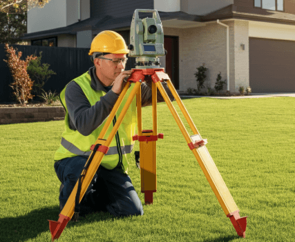
Are there different types of land surveys in Thonotosassa, Florida?
- Boundary Survey: A boundary survey determines a piece of land’s exact property lines and corners. It’s essential for resolving disputes with neighbors and ensuring you know the precise limits of your property.
- Topographic Survey: This survey provides a detailed overview of your property’s natural and man-made features, such as slopes, trees, and structures. It is commonly used to support construction planning and land development projects.
- ALTA/NSPS Survey: An ALTA survey is used in commercial property transactions to meet detailed national standards. It provides information about boundaries, improvements, easements, and any potential risks tied to the land.
- Construction Survey: A construction survey lays out the design plans on the ground before a project begins. It ensures structures are built in the correct locations according to the project’s blueprints.
- Subdivision Survey: This survey is required to divide a large parcel of land into smaller, individual lots. It helps in planning new developments and ensures the new parcels adhere to local regulations.
- Environmental Survey: An environmental survey focuses on identifying any environmental factors or concerns on a property, like wetlands or protected species habitats. It’s required for many development projects to ensure they comply with environmental regulations.
- Mortgage Location Survey: Lenders often require a mortgage location survey before approving a loan for a property. The survey verifies the property boundaries and ensures there are no encroachments that could affect the title or loan agreement.
How long does it take to complete a land survey in Thonotosassa, Florida?
The time needed to complete a land survey in Thonotosassa, Florida, often depends on several factors.
For a basic boundary survey of a small property, it might take just a few days.
Larger properties or those requiring more detailed surveys, like topographic or ALTA surveys, may need one to two weeks.
The landscape of the land can also influence the timeline; properties with dense trees, uneven terrain, or difficult access could take longer.
Severe weather conditions, including heavy rainfall or extreme heat, can lead to delays in progress.
The availability of the surveyor and the need for permits or additional research can also impact how quickly the survey is finished.
The process can go faster if you prepare beforehand by clearing the property and providing past survey documents.
Keeping the land survey cost in Thonotosassa, Florida, in mind as you plan can help ensure a smooth and timely experience.
What documents should I provide to the surveyor before the survey begins?
1. Property Deed
A property deed is a legal document that serves as proof of land ownership while clearly defining its official boundaries.
It contains the legal description of your property, which the surveyor will use for accurate measurements.
Sharing this document ensures the surveyor starts the work with the correct information.
2. Past Survey Records
If you have copies of previous land surveys, share them with the surveyor.
Past surveys provide useful information about the land’s existing boundaries, easements, and structures.
This can save time by giving the surveyor a reliable starting point for their work.
3. Plat Map
A plat map shows the layout of your property and how it fits within the surrounding lots and streets.
It’s useful for identifying the subdivision layout, property lines, and neighboring parcels.
Providing this map helps the surveyor confirm any official lot divisions that might impact the survey.
4. Zoning Documentation
Zoning documents outline how the land can legally be used for residential, commercial, or industrial purposes.
These details are essential if the survey is for new construction or development.
By including zoning information, the surveyor can ensure their work aligns with local regulations.
5. Property Tax Records
Your property tax records include details like your parcel number and the official size of the property.
These records help verify the property against local government databases and ensure accurate identification.
Providing this document can prevent confusion and speed up the process.
How do I prepare my property in Thonotosassa, Florida, for a land survey?
Preparing your property in Thonotosassa, Florida, for a land survey involves a few important steps to ensure the process goes smoothly.
First, clear any obstacles like overgrown vegetation, debris, or structures that might block access to the land.
If there are property markers like fences or boundary posts, make sure they are visible and in good condition.
Inform your neighbors about the survey, especially if their property borders yours, so there are no surprises or disputes during the process.
Gather essential documents such as old surveys, property deeds, or plat maps to provide details about your land.
Checking for permits or legal approvals beforehand can also save time and avoid delays.
Additionally, ensure pets are safely secured to avoid interfering with the survey team’s work.
Keep in mind that careful preparation can help manage timelines and even impact the land survey cost in Thonotosassa, Florida.
If you’re seeking expert advice or considering selling your property, connect with Steve Daria and Joleigh.
As seasoned real estate investors and cash land buyers, they offer personalized guidance tailored to your unique needs.
**NOTICE: Please note that the content presented in this post is intended solely for informational and educational purposes. It should not be construed as legal or financial advice or relied upon as a replacement for consultation with a qualified attorney or CPA. For specific guidance on legal or financial matters, readers are encouraged to seek professional assistance from an attorney, CPA, or other appropriate professional regarding the subject matter.