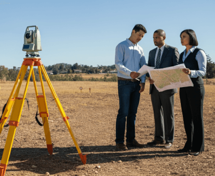
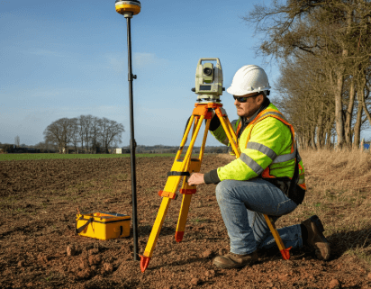
Purchasing land can be a significant and rewarding investment but comes with challenges and complexities. One of the most crucial aspects to consider is understanding the surveying and boundary considerations for land buyers. Accurate surveys and clear boundary definitions ensure that you know exactly what you are purchasing and help avoid potential legal disputes and financial losses in the future. In this blog, we’ll explore why surveying and boundary considerations for land buyers are essential steps in land acquisition. Whether you’re a first-time land buyer or a seasoned investor, getting the correct information can save you time and money.
Real estate investors like Steve Daria and Joleigh have often emphasized the importance of precise land surveys to their clients. They have witnessed firsthand how clear boundary definitions can prevent costly legal disputes and safeguard investments. By following their advice and investing in accurate surveys, buyers can confidently make informed decisions and secure their properties.
What is Land Surveying?
Before discussing the surveying and boundary considerations for land buyers, it’s essential to understand that land surveying is the scientific process of identifying the exact three-dimensional positions of points and the distances and angles between them.
These points are often on the earth’s surface and are used to establish land maps and boundaries for ownership, location, and other purposes.
Surveying is crucial for defining legal property boundaries and preventing disputes.

Types of Land Surveys
Different types of land surveys serve various purposes, each providing specific information about the land.
This section will introduce you to the common types of land surveys and their significance for potential land buyers.
Boundary Surveys
Establish property lines and identify any encroachments or easements.
Topographical Surveys
Topographical surveys capture the contours and features of the land, including trees, buildings, and other structures.
ALTA/NSPS Surveys
Meet rigorous standards for title insurance purposes.
Construction Surveys
Guide construction projects by establishing locations for structures.
Subdivision Surveys
Divide a large parcel of land into smaller lots in compliance with local regulations.
Get Started: Get Your Cash Offer Below…
We are direct land buyers. There are no commissions or fees and no obligation whatsoever. Start below by sharing where your property is and where we can send your offer…
Importance of Boundary Surveys
Boundary surveys are crucial for various reasons, primarily because they establish the legal boundaries of a property.
For land buyers, understanding these boundaries can help:
Avoid Legal Disputes
Knowing the exact boundaries can prevent conflicts with neighbors.
Ensure Proper Land Use
Helps in understanding zoning laws and land use regulations.
Facilitate Construction
Provides accurate data for planning and construction projects.
Protect Investments
Ensures you are getting the land area you are paying for.
Understanding Boundary Markers
Boundary markers serve as crucial demarcations of property lines, providing tangible reference points for landowners, surveyors, and property buyers.
Meticulously placed by surveyors, these physical indicators help establish and maintain clear boundaries between adjacent properties, preventing disputes and ensuring accurate property assessments.

Common Types of Boundary Markers
- Concrete Monuments: Durable and long-lasting, often used in essential surveys.
- Metal Rods: Commonly used and easy to place, but can be disturbed over time.
- Wooden Stakes: Temporary and often used during initial surveys.
- Natural Features: Trees, rocks, or other natural landmarks used historically.
Steps to Navigate Surveying and Boundary Considerations for Land Buyers
Navigating surveying and boundary considerations requires a systematic approach to ensure you are well-informed about the land you intend to purchase.
This section outlines essential steps to help you address these concerns effectively.
Step 1: Hire a Qualified Land Surveyor
Hiring a qualified and experienced land surveyor is the first step in the process.
A professional surveyor will use specialized equipment and techniques to provide accurate boundary information.
Step 2: Obtain a Recent Boundary Survey
Ensure the boundary survey is recent and up-to-date.
An outdated survey may not reflect recent changes or potential encroachments.
Step 3: Review the Survey Report
Review the survey report thoroughly to understand the boundaries, easements, encroachments, and other relevant details.
Step 4: Communicate with Neighbors
Discuss the survey results with neighboring property owners to confirm boundary lines and address discrepancies.
Step 5: Address Easements and Encroachments
Identify and resolve any easements or encroachments that may impact your use of the property.
Strategies for Dealing with Boundary Disputes
Boundary disputes can arise for different reasons, including unclear or incorrect surveys, natural changes to the land, or misunderstandings between property owners.
Here are some strategies to handle these disputes:
Open Communication
Initiate an open and respectful dialogue with the neighboring property owner to discuss the issue and seek a mutually acceptable solution.
Mediation
Consider mediation as a way to resolve the dispute without going to court.
A neutral third party can facilitate negotiations and help reach an agreement.
Legal Action
If communication and mediation fail, legal action may be necessary.
Consult a real estate attorney specializing in boundary disputes to understand your options and the best action.
Survey Reconfirmation
In some cases, a new or updated survey may be needed to clarify the boundaries and provide a definitive resolution to the dispute.
Tips for Land Buyers
Navigating surveying and boundary considerations for land buyers can be complex, but these tips can offer assistance to simplify the process:
Do Your Research
Before purchasing land, research the property’s history, including previous surveys, easements, and any past boundary disputes.
Get Everything in Writing
Ensure all agreements, survey results, and legal descriptions are documented in writing to avoid misunderstandings.
Consult Professionals
Work with qualified professionals, including land surveyors, real estate agents, and attorneys, to supply and guide you through the process and provide expert advice.
Budget for Surveys
Include the cost of land surveys in your budget to avoid surprises and ensure you have accurate information about the property.
Frequently Asked Questions
Understanding the nuances of surveying and boundary considerations is crucial for any land buyer.
This section addresses common questions to help you confidently navigate these essential aspects.
How much does a boundary survey cost?
Boundary survey costs can vary widely based on aspects like the size and complexity of the property, location, and the surveyor’s experience.
On average, it can cost between $500 and $2,000.
How long does it take to complete a boundary survey?
The time required to complete a boundary survey depends on the property’s size and complexity and the surveyor’s workload.
Typically, it can take anywhere from a few days to several weeks.
What should I do if I disagree with my neighbor about the boundary lines?
If you disagree with your neighbor about the boundary lines, try to resolve the issue through open communication and negotiation.
If that fails, consider mediation or consult a real estate attorney.
Can natural features be used as boundary markers?
Yes, natural features such as trees, rocks, or streams can be used as boundary markers.
However, these features can change over time, so it’s essential to have a professional survey to confirm the boundaries.
What is an easement, and how does it affect my property?
An easement is a legal entitlement granting others the right to utilize a section of your property for a particular purpose, such as a utility line or access road.
Easements can affect how you use your property, so it’s essential to identify and understand any easements before purchasing land.
Conclusion
Understanding surveying and boundary considerations for land buyers is crucial. Accurate surveys and clear boundaries help avoid legal disputes, ensure proper land use, and protect your investment. Following the steps and tips outlined in this guide, you can confidently navigate these concerns and make informed decisions about your property.
For more expert advice and insights on surveying and boundary issues, don’t hesitate to contact qualified professionals who can guide you through the process. Knowledge is power, and being well-informed is critical to successful land transactions.
**NOTICE: Please note that the content presented in this post is intended solely for informational and educational purposes. It should not be construed as legal or financial advice or relied upon as a replacement for consultation with a qualified attorney or CPA. For specific guidance on legal or financial matters, readers are encouraged to seek professional assistance from an attorney, CPA, or other appropriate professional regarding the subject matter.
